Aerial Drone Videography | San Francisco Golden Gate Bridge
Aerial drone cinematography of San Francisco and the Golden Gate Bridge, planned for commercial use with licensed, insured FAA Part 107 pilots and integrated into larger corporate and commercial productions.
Aerial Drone Videography of San Francisco
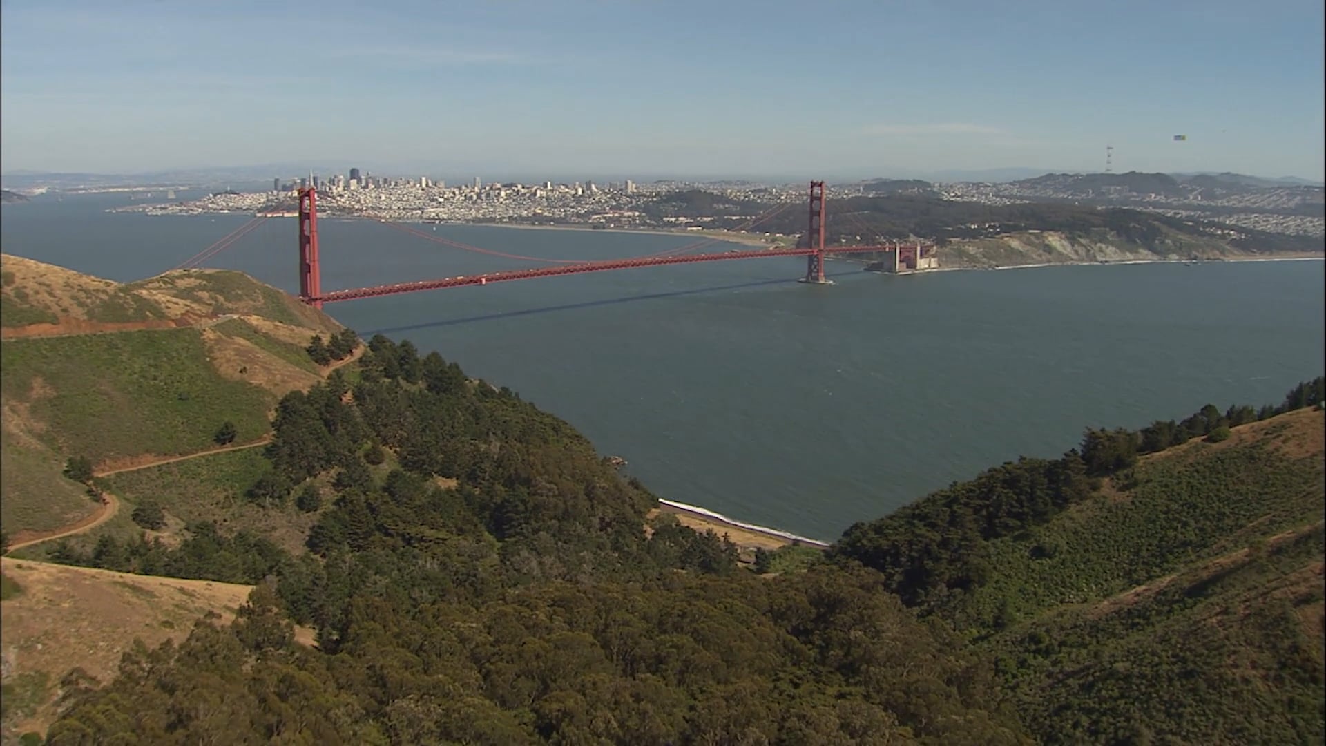
This aerial reel features San Francisco and the Golden Gate Bridge from above, using drone cinematography to establish the scale, geography and visual identity of the Bay Area. The footage works as scenic imagery on its own and as establishing material for larger corporate, commercial, event and destination-focused productions.
Golden Gate Bridge and San Francisco Bay
The Golden Gate Bridge is one of the most recognizable visual anchors in the region. From the air, the relationship between the bridge, the Bay, the coastline and the city becomes immediately legible in a way that is difficult to achieve from ground level.
That makes aerial imagery especially useful when a production needs to communicate place quickly. A wide opening can orient the viewer before a film moves into an office, venue, interview or event, while a more controlled reveal can give a sequence visual scale without requiring a long establishing passage.
Drone Footage With an Editorial Purpose
Our drone video production approach starts with what the finished film needs from the aerial material. A shot may need to establish geography, follow movement, reveal a property, connect two locations or provide a visual transition. The objective is not simply to collect attractive aerial footage, but to capture images that have a clear role in the edit.
That editorial planning affects shot length, direction of movement, altitude, lens choice and time of day. Aerial coverage should connect visually with the ground photography rather than feel like a separate reel dropped into the finished piece.
Licensed and Insured Commercial Drone Operations
Commercial drone production should be handled by a properly qualified operator. Capitola Media works with licensed and insured drone pilots and expects the pilot in command to hold a current FAA Part 107 Remote Pilot Certificate, meet applicable recurrent training requirements and carry aviation liability insurance appropriate to the assignment.
Certification is only one part of flight planning. The operator must review controlled and restricted airspace, obtain any required FAA authorization or waiver, assess temporary flight restrictions and confirm location permissions before filming. Property access does not replace FAA approval where federal authorization is required, and a Part 107 certificate does not make every requested flight automatically permissible.
Planning Around San Francisco Airspace
San Francisco presents additional practical considerations because the region includes major airports, dense urban areas, bridges, waterfront activity, public land and heavily trafficked locations. A proposed aerial shot has to be evaluated against airspace, people on the ground, launch and recovery locations, weather, visibility and the specific operating environment.
For that reason, aerial work should be scoped before a production promises a particular shot. The best creative idea is only useful if it can be flown safely and legally. Where a preferred angle is not feasible, the production can plan an alternative using a different flight path, a ground-based camera, licensed archival footage or graphics.
Location Production and Safety
Site conditions can change quickly. Wind, fog, marine conditions, traffic, public activity and access restrictions may affect when or whether a flight can proceed. The pilot in command makes the final operational decision on the day, while the producer coordinates the aerial plan with the larger schedule and the needs of the client and location.
That separation of responsibilities is important. The creative team defines what the film needs; the pilot determines whether and how the flight can be conducted within applicable regulations and operating limits.
Integrating Aerial and Ground Photography
Aerial footage is most useful when it is designed to work with the rest of the production. Camera direction, movement, exposure, color and framing should support the visual language established by interviews, handheld or stabilized ground footage, product photography and motion graphics.
A short aerial reveal may be all a corporate film needs. A location-driven project may require a more complete sequence showing access, scale and surrounding geography. Defining that purpose in advance helps the aerial operator capture material that will actually survive the edit.
From Flight Planning to Final Delivery
The aerial workflow can include preflight planning, airspace review, coordination with the location, shot-list development, weather monitoring, capture and postproduction integration. In the edit, the strongest movements are selected for pacing and continuity, then color and timing are matched to the surrounding material.
For productions that need San Francisco aerial coverage, share the proposed location, intended subject, filming window and final use early. Those details allow the production team and pilot to assess feasibility, identify required permissions and determine whether the requested coverage can be captured safely and legally.
Have a project in mind?
Tell us what you are making, who it needs to reach, and where production needs to happen.