Aerial footage can reveal scale, geography, movement, and context in a way that a ground camera cannot. It can establish a campus, follow a vehicle, connect several locations, or show how a facility sits within its surroundings. The value comes from what the shot communicates, not simply from placing a camera in the air.
For a corporate production, drone work should be planned as part of the story, schedule, safety process, and edit. A beautiful shot that does not advance the message can add cost without improving the video.
Give every aerial shot a clear job
Start by identifying what the audience needs to understand. A high establishing view can orient viewers. A controlled reveal can introduce a facility or product. A tracking shot can demonstrate motion, access, or scale. A vertical movement can transition from a specific subject to the larger environment.
Experienced drone video production begins with a shot purpose, not a list of maneuvers. The storyboard and schedule should explain where aerial material enters the story and how it connects to interviews, ground coverage, graphics, and sound.
Evaluate feasibility before promising the shot
Commercial drone work in the United States generally falls under Federal Aviation Administration rules for small unmanned aircraft. Planning may involve a qualified remote pilot, aircraft registration, Remote ID requirements, airspace review, and authorization for controlled airspace. The exact operation also depends on altitude, proximity to people or moving vehicles, visibility, local restrictions, property access, and other site conditions.
The producer should review the location early and avoid guaranteeing a flight before feasibility is confirmed. Airports, temporary flight restrictions, dense public areas, emergency activity, weather, and site policies can change what is possible. When an intended operation cannot be conducted safely and lawfully, the team needs an alternate shot.
Coordinate permissions and site control
Airspace authority and permission to use a property are separate considerations. Confirm site access with the property owner or manager, identify takeoff and landing areas, and establish how the crew will keep participants and the public clear of the operation. A scout should note obstacles, reflective surfaces, power lines, radio interference, animals, traffic, and areas that contain private or sensitive information. This coordination is especially important for real estate and property video, where the most appealing angle may cross a boundary, include neighboring property, or reveal activity that cannot appear in the final edit.
Match the aerial camera to the production
Frame rate, resolution, color settings, lens character, and movement should complement the ground cameras. The editor needs enough visual continuity to move between perspectives without making the drone footage feel like a separate video. Plan screen direction, time of day, sun position, and movement with the director of photography.
Sound also matters. A drone shot may use location sound recorded before or after the flight, interview audio, music, or designed effects. The aircraft audio itself is rarely the storytelling element, so the sound plan should be intentional.
Build weather and timing alternatives
Wind, precipitation, visibility, and changing light can affect both safety and image quality. Build a weather decision point into the schedule and identify ground based alternatives. If the aerial sequence is essential, consider a separate flight window rather than forcing it into a crowded production day.
Urban work in the San Francisco Bay Area can involve complex airspace, changing marine weather, crowded sites, and sensitive infrastructure. Early planning gives the team more options and helps protect the rest of the schedule.
Use aerial footage with restraint
A few purposeful shots often have more impact than a long montage. Use the aerial perspective to clarify location, reveal scale, support a transition, or create an emotional shift. Then return to the people, products, and details that carry the story. When drone footage is integrated thoughtfully, it expands the visual language without becoming the subject of the video.
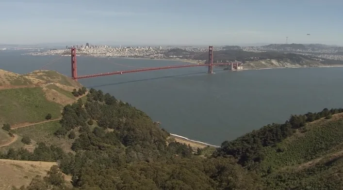
Production Context: Golden Gate aerial imagery
Golden Gate aerial imagery. Scenic aerial footage can establish a location and give viewers a sense of its scale. The flight plan, permissions and operating conditions must be established separately for each new assignment.